I geotag all of the pictures I can. Why? Well because I think it is cool to be able to go back and see exactly where I took the pictures. I don’t have to remember. Now, I’m careful about pictures I take at home, etc….
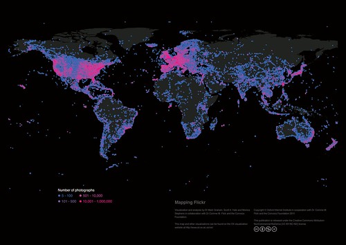
but, as an example of the usefulness of this, check out what this guy did. He made this map showing how many pictures are in each lat/long square in the earth. Pretty cool. The image above is what he made.
Image from Oxford Internet Institute via my flickr account;